Tag Archive for: EPA

Celebrating 55 years of GIS-based EHS data insights

GIS Day was established in 1999 to showcase the power and flexibility of geographical information systems (GIS).  In celebration of the 55th birthday of GIS, we’ve compiled a brief history of the evolution of this powerful technology, with a special focus on how it can be used in EHS applications to make environmental management easier.

Not only is GIS more powerful than ever before—it is also vastly more accessible.  Anyone with Internet access can create custom maps based on publicly available data, from real-time traffic conditions to environmental risk factors, to local shark sightings. Software developers, even those at small companies or startups, now have access to APIs for integrating advanced GIS tools and functionality into their programs.

Origins of GIS

Before you can understand where GIS is today, it helps to know how it started out. This year is the 55th anniversary of the work done by Roger Tomlinson in 1962 with the Canada Land Inventory. We consider this the birth of GIS, and Mr. Tomlinson has been called the “father of GIS”.

The original GIS used computers and digitalization to “unlock” the data in paper maps, making it possible to combine data from multiple maps and perform spatial analyses. For example, in the image shown here from the Canada Land Inventory GIS, farms in Ontario are classified by revenue to map farm performance.
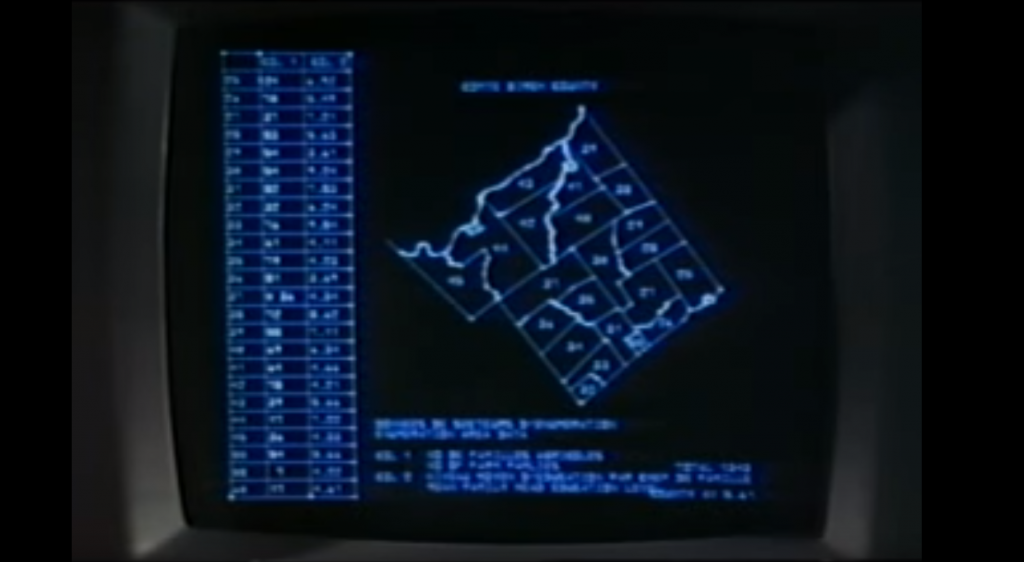
An early GIS system from the Canada Land Inventory, in Data for Decisions, 1967

An early GIS system from the Canada Land Inventory, in Data for Decisions, 1967
Photo: Mbfleming. “Data for Decisions (1967).” YouTube, 12 Aug. 2007, https://youtu.be/ryWcq7Dv4jE.
  Part 1, Part 2, Part 3

In 1969, Jack Dangermond founded Esri, which became the maker of, arguably, the world’s most popular commercial GIS software. Esri’s first commercial GIS, ARC/INFO, was released in 1982, and the simpler ArcView program followed in 1991. Many of today’s most skilled GIS software developers can trace their roots back to this original GIS software.

Back then, GIS work required expensive software packages installed on personal computers or large mainframe systems. There was no Google Maps; all map data had to be manually loaded into your software. Getting useful data into a GIS usually required extensive file manipulation and expertise in coordinate systems, projections, and geodesy.

While the government, utility, and resource management sectors used GIS heavily, there was not much consumer or personal use of GIS. Early GIS professionals spent much of their time digitizing paper maps by hand or trying to figure out why the map data loaded into a GIS was not lining up properly with an aerial photo. This may sound familiar to those who have been in the environmental industry for awhile.
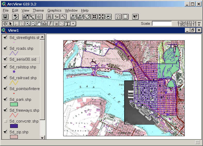
Esri’s ArcView 3.2 for desktop computers (from the 1990s)

Esri’s ArcView 3.2 for desktop computers (from the 1990s)
https://map.sdsu.edu/geog583/lecture/Unit-3.htm

The Google Revolution

How much has changed since those early days! After the release of OpenStreetMap in 2004, Google Maps and Google Earth in 2005, and Google Street View in 2007, GIS has been on an unstoppable journey—from only being used by dedicated GIS professionals on large computers in specific workplaces, to be accessible to anyone with an internet browser or a smartphone. High-quality map data and images—often the most expensive item in a GIS project in the 1990’s — are now practically free.

Just think how revolutionary it is that anyone can have instant access to detailed satellite images and road maps of almost anywhere on Earth! Not only can you perform such mundane tasks as finding the fastest route between two cities or locating your favorite coffee shop while on vacation—you can also see live traffic conditions for cities across the globe; view aerial images of countries you have never visited; track waste drums around your facility; and get street level views of exotic places. Back in 1991, such widespread access to free map data would have seemed like something straight out of science fiction.
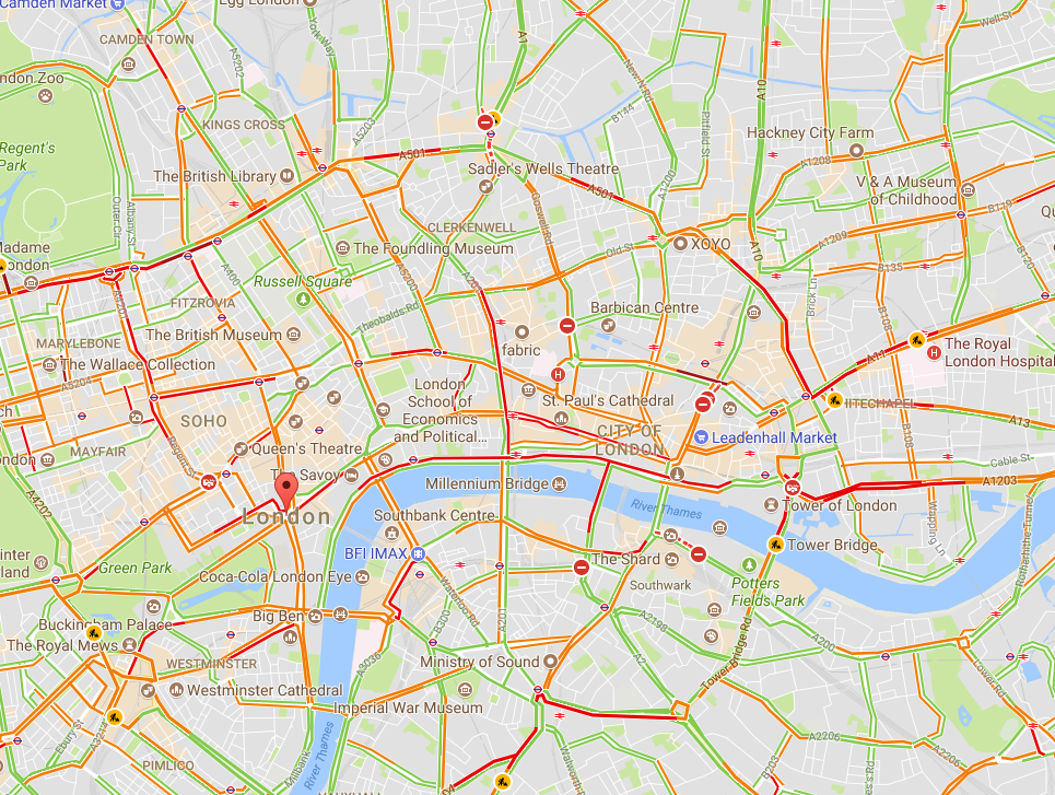
Traffic conditions in London, 3:30 pm 10/16/2017, from Google Maps

Traffic conditions in London, 3:30 pm 10/16/2017, from Google Maps

South Base Camp, Mount Everest, Google StreetView

South Base Camp, Mount Everest, Google StreetView

Mashups in the cloud

Obviously, the amount of spatial data needed to provide detailed coverage of the entire globe is far too large to be stored on one laptop or phone. Instead, the data is distributed across many servers “in the cloud.” Back in the 1990s, everything for one GIS system (data, processing engine, user interface) needed to be in the same physical place—usually one hard drive or server. Now, thanks to the internet and cloud computing, the data can be separate from the software, creating “distributed” GIS.

The combination of freely available data with distributed GIS and the power of smart phones has led us to the age of “neogeography”—in which anyone (with some technical knowledge) can contribute to online maps, or host their maps with data relevant to their personal or professional needs. GIS no longer requires expensive software or cartographical expertise; now, even casual users can create maps linking multiple data sources, all in the cloud.

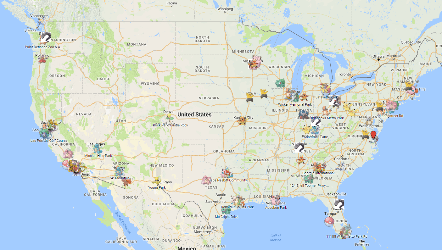
Google’s MyMaps is an example of a tool for easily making your maps. Maps can range from the playful, such as locations of “Pokemon nests,” to the serious, such as wildfire conditions.
These online maps can be updated in real time (unlike paper maps) and therefore kept current with actual conditions. Such immediate response is instrumental in emergency management, where conditions can change rapidly, and both first responders and the public need access to the latest data.
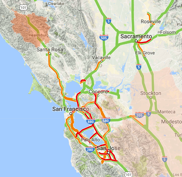
Map showing wildfire and traffic conditions in northern California, 10/16/2017

Map showing wildfire and traffic conditions in northern California, 10/16/2017
https://google.org/crisismap/us-wildfires

Furthermore, software programmers have created online GIS tools that let non-coders create their maps. These tools push the boundaries of distributed GIS even further by putting the processing engine in the cloud with the data. Only the user interface runs locally for a given user. During this period of GIS history, it became easy to create “mashups” for viewing different types of disparate data at once, such as natural hazard risks near offices, pizza stores near one’s neighborhood, EPA Superfund sites near one’s home, property lines, flood plains, landslide vulnerability, and wildfire risk.
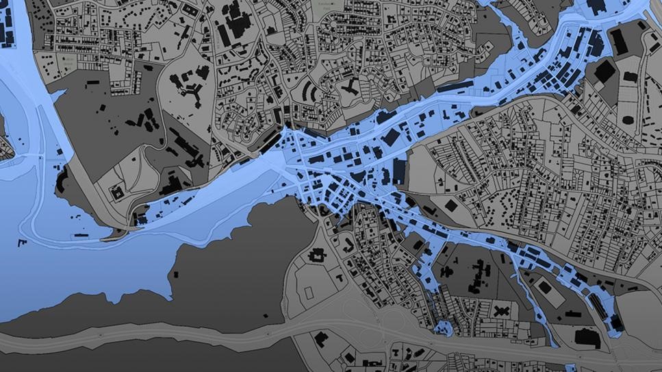
Floodplain data for Buncombe County, NC

Floodplain data for Buncombe County, NC
https://buncombe-risk-tool.nemac.org

Programming GIS with APIs

Another significant advance in GIS technology is the ability to integrate or include advanced GIS tools and features in other computer programs. Companies such as Google and Esri have provided toolkits (called APIs, or application programming interfaces) that let coders access GIS data and functions inside their programs. While neogeography shows the power of personal maps created by the untrained public, computer programmers can use APIs to create some very sophisticated online GIS tools aimed at specific professionals or the public.

One example is the publicly-available Intellus application that Locus Technologies developed and hosts for the US Department of Energy’s Los Alamos National Laboratory. It uses an Esri API and distributed GIS to provide access to aerial images and many decades of environmental monitoring data for the Los Alamos, NM area. Users can make maps showing chemical concentrations near their home or workplace, and they can perform powerful spatial searches (e.g., “find all samples taken within one mile of my house in the last year”). The results can be color-coded based on concentration values to identify “hot spots”.
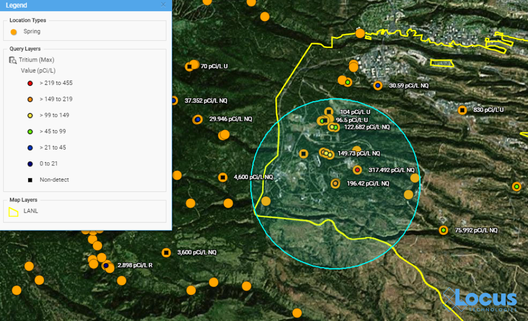
Map from Intellus showing Tritium concentrations near a specified location

Map from Intellus showing Tritium concentrations near a specified location
https://www.intellusnmdata.com

Another example of more sophisticated forms of analysis is integration of GIS with environmental databases. Many government facilities and private vendors incorporate GIS with online data systems to let public users evaluate all types of information they find relevant.

For example, contour lines can be generated on a map showing constant values of groundwater elevation, which is useful for determining water flow below ground. With such powerful spatial tools in the cloud, any facility manager or scientist can easily create and share maps that provide insight into data trends and patterns at their site.
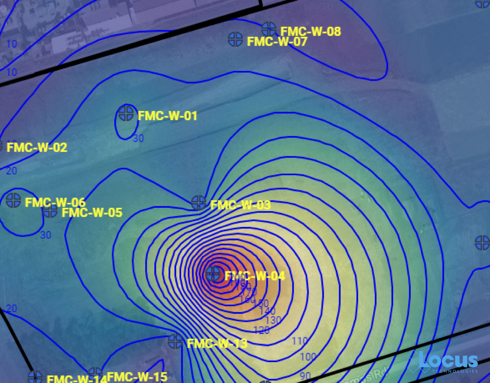
Groundwater contour map

Groundwater contour map where each line is a 10 ft. interval, from the Locus EIM system

Other examples include monitoring air emissions at monitoring sites (like US EPA’s AirData Air Quality Monitors, shown below) and actual stream conditions from the USGS (also shown below).
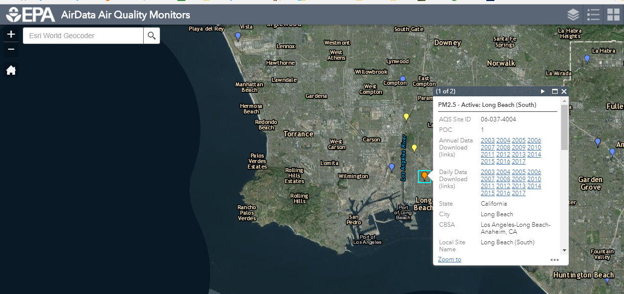
Screen capture of air quality data from US EPA AirData GIS app

Screenshot from US EPA AirData Air Quality Monitors interactive GIS mapping platform, showing Long Beach, California
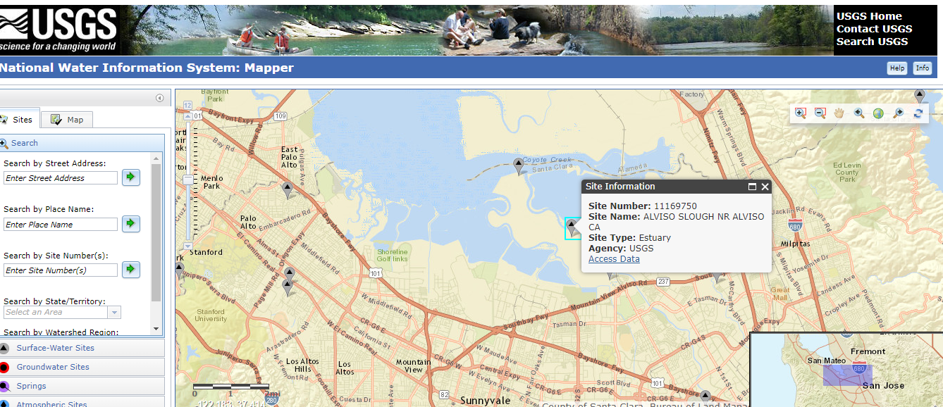
 

Screen capture of USGS National Water Information System interactive GIS map tool

Screen capture of USGS National Water Information System interactive GIS map tool, showing a site in Mountain View, California

There’s a (map) app for that

One particularly exciting aspect of GIS today is the ability to use GIS on a smartphone or tablet. The GIS APIs mentioned above usually have versions for mobile devices, as well as for browsers. Programmers have taken advantage of these mobile APIs, along with freely available map data from the cloud, to create apps that seamlessly embed maps into the user experience. By using a smartphone’s ability to pinpoint your current latitude and longitude, these apps can create personalized maps based on your actual location.

A search in the Apple AppStore for “map” returns thousands of apps with map components. Some of these apps put maps front-and-center for traditional navigation, whether by car (Waze, MapQuest, Google), public transit (New York Subway MTA Map, London Tube Map), or on foot (Runkeeper, Map My Run, AllTrails). Other apps use maps in a supporting role to allow users to find nearby places; for example, banking apps usually have a map to show branches near your current location.

What’s really exciting are the apps that allow users to enter data themselves via a map interface. For example, HealthMap’s Outbreaks Near Me not only shows reports of disease outbreaks near your location, but it also lets you enter unreported incidents. The GasBuddy app shows the latest gasoline prices and lets you enter in current prices. This “crowdsourcing” feature keeps an app up-to-date by letting its users update the map with the latest conditions as they are happening.
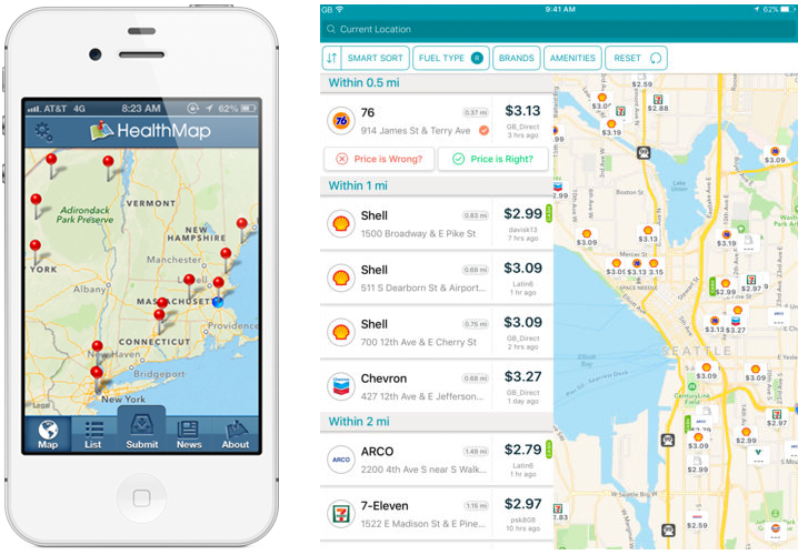
The Outbreaks Near Me app for phones (left) and the GasBuddy app for tablets (right)

The Outbreaks Near Me app for phones (left) and the GasBuddy app for tablets (right)

EHS professionals can further harness the power of GIS using mobile applications.  For example, in the Locus Mobile app for field data collection, users can enter environmental data—such as temperature or pH measurements—from a sampling location, then upload the data back to cloud-based environmental management software for immediate review and analysis. Mobile apps can also support facility compliance audits, track current locations of hazardous waste drums, collect on-scene incident data (complete with photos), and record exact locations for mapping by colleagues back in the office.

GIS-enabled mobile apps also typically include a map interface for navigating to data collection points and tracking visited locations. Other key features to look for include ad hoc location creation for capturing unplanned data—this lets users create new data collection points “on the fly” simply by clicking on the map.
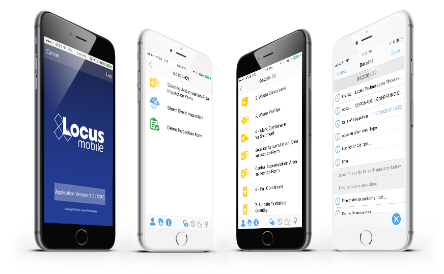
Locus Mobile App

Views of many different mobile app use cases from tracking drums to collecting field data

A bright future for GIS applications within EHS software

Where will GIS as a whole go from here? It’s possible that augmented reality, virtual reality, and 3D visualization will continue to expand and become as ubiquitous as the current “2D” maps on browsers and phones. Also, the “internet of things” will surely have a GIS component because every physical “thing” can be tied to a geographical location. Similarly, GIS can play an important role in “big data” by providing the spatial framework for analysis.

GIS is one of the most effective ways to convey information to a wide range of users, from corporate managers looking at the company’s key metrics to operational personnel looking for incidents across facilities and trying to find trends. It is a highly intuitive data query interface that empowers users to explore the data hidden deep in enterprise EHS databases. The examples presented above are just the tip of the iceberg for the range of possibilities to simplify communication of information and look more broadly across enterprises to identify where real or potential issues lie.

An EHS software system should have many ways to extract data and information to form insights beyond a few “canned” reports and charts. A spatially-accurate picture can often provide more actionable insight than tables and text. Imagine being able to see spill locations, incident locations, environmental monitoring stations for air quality, wastewater outfalls, central and satellite waste accumulation area locations, and PCB and asbestos equipment and/or storage locations—all visually represented on an actual map of your facility and its surroundings. All these types of maps are invaluable in an enterprise EHS software system and should be a critical item on your checklist when selecting software for your EHS needs.

Thanks to the GIS Timeline for providing some of the history for this article.


Locus employee Todd PierceAbout guest blogger— Dr. Todd Pierce, Locus Technologies

Dr. Pierce manages a team of programmers tasked with development and implementation of Locus’ EIM application, which lets users manage their environmental data in the cloud using Software-as-a-Service technology. Dr. Pierce is also directly responsible for research and development of Locus’ GIS (geographic information systems) and visualization tools for mapping analytical and subsurface data. Dr. Pierce earned his GIS Professional (GISP) certification in 2010.


[jwplayer mediaid=”16590″]

Interested in Locus’ GIS solutions?

Introducing Locus GIS+. All the functionality you love in EIM’s classic Google Maps GIS for environmental management— now integrated with the powerful cartography, interoperability, & smart-mapping features of Esri’s ArcGIS platform!

Learn more about GIS+


EPA issues Final Rule for regulating formaldehyde emissions

Six years after the passage of the Formaldehyde Emission Standards for Composite Wood Products Act of 2010 (42 U.S.C. 2697), the US Environmental Protection Agency (EPA) has issued its final rule implementing the Act (Final Rule). The Final Rule—based on the formaldehyde regulation released by the California Air Resources Board (with which EPA collaborated in formulating the Final Rule)—seeks to reduce exposure to formaldehyde vapors by establishing emission standards and labeling requirements for certain wood products.

Final rule seeks to reduce exposure to formaldehyde vapors by establishing emission standards and labeling requirements for certain wood products.

Formaldehyde is a chemical that is commonly used in wood glue for furniture and flooring. Some studies have linked formaldehyde to nasopharyngeal cancer, eye irritation, and respiratory problems, while other studies have raised questions about the chemical’s potential role in causing asthma and allergic conditions, particularly among children.

In 2008, in response to these health concerns, California became the first US jurisdiction to issue emission limits on formaldehyde in building materials and furniture used in homes. Two years later, the US Congress enacted the Formaldehyde Emission Standards for Composite Wood Products Act, which added Title VI to the Toxic Substances Control Act (TSCA). This Act directed EPA to issue regulations implementing the Act.

The Final Rule sets formaldehyde emission standards applicable to hardwood plywood, medium-density fiberboard and particleboard, and finished goods containing these products that are sold, supplied, offered for sale, imported into, or manufactured in the United States. To show that they are in compliance with the emission standards, within one year, these products will need to be labeled as TSCA Title VI compliant. Furthermore, the Final Rule establishes an EPA TSCA Title VI Third-Party Certification Program to ensure that composite wood panel producers comply with the emission limits. Under this program, Third-Party Certifiers (TPCs) will regularly inspect composite wood panel producers and conduct emissions tests. TPCs who wish to participate in the program must apply to EPA for approval and receive program recognition before certifying products.

Products that contain de minimis amounts of composite wood products (defined as products containing 144 square inches or less of regulated composite wood products) are exempt from the labeling requirements.

Some small businesses have argued that the rule’s testing, labeling, and record-keeping requirements will disproportionally impact smaller firms that aren’t equipped to handle additional costs.

About $10 billion = The 2014 Corporate EHS Non-compliance and Fines Cost

The U.S. Environmental Protection Agency (EPA) released its annual enforcement and compliance results revealing both the cleanup improvements as well as compliance fines industries have made in 2014. In this report, the agency focused on large, high impact enforcement cases. Environmental Cleanup Improvements:

  • Reductions of an estimated 141 million pounds of air pollutants, including 6.7 million pounds of air toxics.
  • Reductions of approximately 337 million pounds of water pollutants.
  • Clean up of an estimated 856 million cubic yards of contaminated water/aquifers.

Investment and Fines
Enforcement guidelines this year required companies to invest more than $9.7 billion in actions and equipment to control pollution as well as clean up contaminated sites. EPA’s non-compliant cases resulted in $163 million in combined federal administrative, civil judicial penalties, and criminal fines. EPA holds criminal violators accountable that threaten the health and safety of American residents.

“Despite challenges posed by budget cuts and a government shutdown, we secured major settlements in key industry sectors and brought criminal violators to justice. This work resulted in critical investments in advanced technologies and innovative approaches to reduce pollution and improve compliance,” said Cynthia Giles, Assistant Administrator for EPA’s Office of Enforcement and Compliance Assurance.
Companies can reduce their non-compliance risks and lower their monitoring and reporting costs by implementing enterprise EHS and Sustainability software to automate information management, compliance, and monitoring for exceedances for a fraction of what potential fines could cost them. Once a non-compliance fine is imposed the cost of brand damage could be even worse and incalculable.

Companies Make Strides Toward Enforcing Oil Spill Prevention Plans

In recent years, the Environmental Protection Agency (EPA) has become much more vigilant about oil spill regulation—regardless of the spills origin. After a series of inspections over the past two years, the EPA announced seven New England companies who have all created or updated their spill prevention plans to be in compliance with federal oil pollution prevention laws.

The companies, who all store or distribute oil, agreed to pay fines under an expedited settlement program, their penalties ranging from $3,000 to $9,500. This expedited program allows companies to pay reduced penalties if they quickly correct violations against the Oil Pollution Prevention regulations. These companies also were required to have a certain minimum storage capacity with no accompanying spill in order to qualify for these reduced fines.

The EPA’s Spill Prevention, Control and Countermeasure (SPCC) rules designate certain requirements for oil spill prevention, preparedness, and response to prevent oil discharges into navigable waters and adjoining shorelines. These rules call for facilities to adhere to guidelines pertaining to their ability to prepare, amend and implement SPCC Plans.

For many companies, complying with these regulations created by the EPA requires an additional focus on detailed actions in SPCC procedures.  Often times tracking and reporting spills if and when they occur—along with the root causes and inspection findings—can be a significant challenge without the appropriate management tools. However, when properly prepared, abiding by these necessary SPCC rules will ensure that organizations stay within compliance, thus avoiding fines and penalties and any harsh effects on our environment.

Obama Administration Unveils Plan to Cut Power Plant Emissions

The Obama Administration has announced what is arguably the most significant environmental regulation of the president’s term: a proposal to curb power plant emissions that will mandate a 30 percent cut in carbon emissions at fossil fuel-burning power plants by 2030.

The proposal was unveiled by the U.S. Environmental Protection Agency (EPA), and is expected to set targets for state-by-state reduction of power plant-produced carbon emissions; the largest source of carbon pollution in the U.S. According to the proposal, states could have until 2017 to submit a plan to cut power plant pollution, or 2018 if they join together with other states to address the issue.

In 2010 the EPA announced it intended to regulate coal-fired power plants and oil refineries, but this effort was not followed through. However, due to factors such as improvement in the economy and the natural gas boom, the White House and advocates feel that the time is right.

According to a poll conducted by the Yale Project on Climate Change Communication in April, two-thirds of Americans support increased regulation on power plant emissions, even if the cost of electricity rises.

The success of the carbon emission-cutting rule will depend on pending details, such as exactly how strict the targets are and how the federal government holds states to them. Although U.S. emissions have been declining recently due to increased use of natural gas to generate electricity, the country is still second to China in terms of annual emissions.

Along with this proposal comes the importance of accurately and efficiently collecting, aggregating and reporting emission sources data. An essential piece to the puzzle of addressing climate change and abiding by new rules and regulations is properly measuring and managing information.

EPA Takes Cross-Country Road Trips for New Climate Rules Targeting Coal-fired Power Plants

Ms. Gina McCarthy, Environmental Protection Agency (EPA) administrator and chief architect and emissary to President Obama’s plan to fight climate change, has recently taken to the road to pitch new climate change regulations.

While these EPA regulations set limits on carbon emissions from coal-fired power plants and are meant to decrease greenhouse gas emissions in the U.S., the rules could also be so strict that they result in a large number of plants being shut down and mining jobs lost.

The EPA is set to roll out the two new rules by the end of Mr. Obama’s presidency. This past September the EPA announced the draft of the first rule, which would limit carbon pollution from future power plants, and this upcoming June 2014 the EPA will release the draft of the second rule, which is said to require emission cuts at existing coal-fired power plants. Final versions of both rules are expected by June 2015, and states will have until mid-2016 to submit compliance plans.

While the EPA will establish a federal standard for reducing carbon emissions, individual states will be in charge of carrying out these new rules. This is meant to give each state the flexibility to configure its own plan. However, this creates the possibility that states who oppose these new rules may attempt to refuse or delay them from taking effect.

These trips to various U.S. states are a new ploy for the EPA and Ms. McCarthy, who is well aware of how cutting-edge these set of rules are and the intense scrutiny that they face. The rules will impose additional cost to the coal industry in order to stay in compliance and will require better information management and reporting tools.

AWWA introduces updated cost assessment for impending perchlorate regulation

The American Water Works Association (AWWA) recently introduced a new assessment on the cost-impact of an impending perchlorate regulation. The decision to move forward with the development of this regulation “to protect Americans from any potential health impacts, while also continuing to take steps to ensure the quality of the water they drink” was officially announced by the U.S. Environmental Protection Agency (EPA) in early 2011.

Perchlorate is both a man-made and naturally occurring chemical that can be found in some bleaches and fertilizers, and is used to manufacture flares, explosives, fireworks, and rocket fuel. Scientific research finds that perchlorate may negatively impact the thyroids ability to produce hormones that are essential to the development of fetuses and infants- propelling the EPA forward to develop a rule.

In an effort to further evaluate the feasibility of the new regulation, the AWWA’s new assessment updates a review of cost done four years ago. The new evaluation includes additional treatment strategies, accounts for regulatory limits already in place in California and Massachusetts, and considers costs associated with blending, source abandonment, and development of new sources.

The new assessment concludes that the estimated national compliance costs for a perchlorate maximum contaminant level ranging from 2 to 24 parts per billion (ppb) is smaller than estimated compliance costs for other drinking water regulations.

However, according to AWWA Government Affairs, the relatively small compliance cost is most likely attributed to the limited number of public water systems that are expected to be affected by a perchlorate regulation. Because of this, the economic impact to individual water systems is expected to be substantial. For example, smaller water systems could see treatment costs increase by three dollars per 1,000 gallons.

To view the AWWA’s full assessment:

https://www.locustec.com/wp-content/uploads/2019/11/AWWA2013PerchlorateCostAssessment.pdf

For further information on perchlorate:

http://water.epa.gov/drink/contaminants/unregulated/perchlorate.cfm

EPA Looks for Improved Drilling Data

According to the Energy Information Administration, production of natural gas from shale formations has increased approximately 30 percent from 2006 to 2012. This increase, due to advancements in drilling technologies, has caught the EPA off guard and left it with limited knowledge about the amount of pollutants entering the groundwater, surface water or air.

This poses an issue because states rely on the EPA’s information when issuing permits or determining if someone breaks a rule, and these decisions are being compromised if they are reliant on non-existent or questionable water quality or air emissions data. This realization is also a bit concerning considering hydraulic fracturing releases chemicals such as methane, the main component of natural gas and also a potent greenhouse gas.

The EPA has agreed it needs to improve its data, and is working with the appropriate parties to ensure the continued expansion of oil and natural gas drilling is done safely and responsibly. This situation shows that being prepared to handle big data like this is vitally important. Locus’ EIM and ePortal software are Cloud-based platforms for effectively managing air emissions, as well as hydrofracking data of any kind, water, groundwater, SPCC, and compliance information. By managing this information in one, easily accessible, web-based platform it is easier to stay on top of essential data collection, and to make sure your data quality is at its best.

President Obama Addresses Climate Change

In President Obama’s recent State of the Union, he chose to address the issue of climate change more than has ever been done before in presidential history. He spoke about how floods, droughts, storms, and wildfires have all been more frequent and extreme than ever, and stated that the 12 hottest years on record have all been within the past 15.

In addition to the dangers that the effects of climate change pose, there is also the threat of a financial problem, with the cost of rebuilding New York and New Jersey after Hurricane Sandy being approximately $60 billion.

Obama certainly met the expectation of environmentalists during his speech by acknowledging these threats, and stated he would take action to control carbon dioxide pollution. He even stated that if Congress would not act soon, he would direct his Cabinet to form actions that can be taken to reduce pollution, transition to sustainable forms of energy, and be better prepared for the results of climate change.

A variety of options can be pursued to accomplish these goals, one of which being the EPA cracking down on carbon-dioxide emissions from power plants, and regulating this as a pollutant. But, one thing is for certain: the recognition of climate change and the need for protection is currently in the public eye more than it has ever been before. It is becoming even more crucial for organizations to properly manage and keep track of their environmental, emissions, and compliance data. This is why Locus will continue to work hard to offer companies the most comprehensive SaaS platforms available today to manage and organize their critical environmental information.

EPA Researches Possible Impacts of Hydrofracking on Drinking Water

Thanks to advances in horizontal drilling and hydraulic fracturing technologies, the U.S. now has access to immense reserves of natural gas. While the proper development of this resource offers numerous benefits for our country, it has also become clear that as the use of hydrofracking has gone up, so has the concern about its possible health and environmental impacts, particularly on drinking water.

I recently came across the report that the U.S. Environmental Protection Agency (EPA) released in December 2012 in response to this concern, Study of the Potential Impacts of Hydraulic Fracturing on Drinking Water Resources. Its purpose is to determine and examine the possible impacts of hydrofracking on our drinking water, and to identify what exactly causes these impacts.

The EPA’s research set out to answer questions that focus on the five stages of the hydrofracking water cycle: water acquisition, chemical mixing, well injection, flowback and produced water, and wastewater treatment and waste disposal. The report describes the progress made as of September 2012 on 18 research projects, and covers research activities such as laboratory studies, toxicity assessments, and case studies.

With drinking water being at the top of the list of precious resources, this is yet another reminder that hydrofracking must be engaged in responsibly, and that it is important for energy companies to be transparent in the management of their data. For that reason, Locus has developed a special functionality within its award-winning SaaS application EIM to help upstream divisions of oil and gas companies better manage and account for their data associated with hydrofracking.

Tag Archive for: EPA

Nothing Found

Sorry, no posts matched your criteria