Environmental Technology Blog
 https://www.locustec.com/wp-content/uploads/2023/04/VlogScreenshot.png
395
592
Nancy-Jeanne LeFevre
https://www.locustec.com/wp-content/uploads/2023/12/locus_logo_2x.png
Nancy-Jeanne LeFevre2024-05-14 13:07:052025-09-16 14:02:54Cap-and-trade compliance deadlines
https://www.locustec.com/wp-content/uploads/2023/04/VlogScreenshot.png
395
592
Nancy-Jeanne LeFevre
https://www.locustec.com/wp-content/uploads/2023/12/locus_logo_2x.png
Nancy-Jeanne LeFevre2024-05-14 13:07:052025-09-16 14:02:54Cap-and-trade compliance deadlines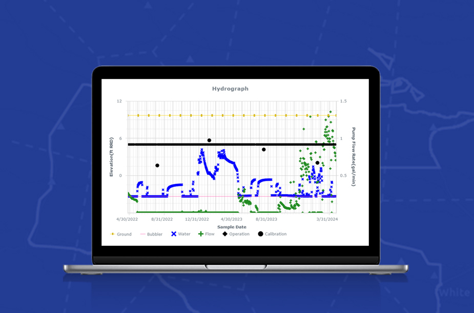 https://www.locustec.com/wp-content/uploads/2024/05/AdvancedVisuals-1.jpg
611
925
Dr. Todd Pierce
https://www.locustec.com/wp-content/uploads/2023/12/locus_logo_2x.png
Dr. Todd Pierce2024-05-10 10:31:222025-09-16 13:52:40Go Beyond Line Charts
https://www.locustec.com/wp-content/uploads/2024/05/AdvancedVisuals-1.jpg
611
925
Dr. Todd Pierce
https://www.locustec.com/wp-content/uploads/2023/12/locus_logo_2x.png
Dr. Todd Pierce2024-05-10 10:31:222025-09-16 13:52:40Go Beyond Line Charts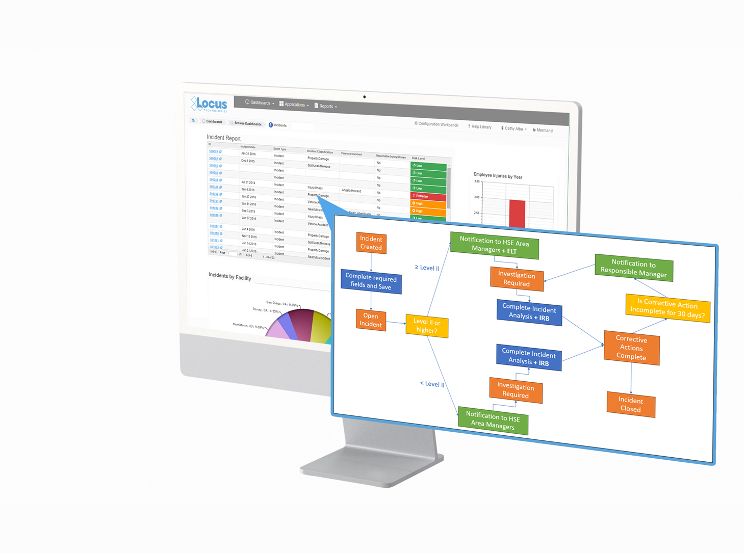 https://www.locustec.com/wp-content/uploads/2024/05/Incident_Blaize.jpg
1085
1459
Blaize Ison
https://www.locustec.com/wp-content/uploads/2023/12/locus_logo_2x.png
Blaize Ison2024-05-08 16:44:542025-09-17 07:36:54Improving Workplace Safety with Incident Management Software
https://www.locustec.com/wp-content/uploads/2024/05/Incident_Blaize.jpg
1085
1459
Blaize Ison
https://www.locustec.com/wp-content/uploads/2023/12/locus_logo_2x.png
Blaize Ison2024-05-08 16:44:542025-09-17 07:36:54Improving Workplace Safety with Incident Management Software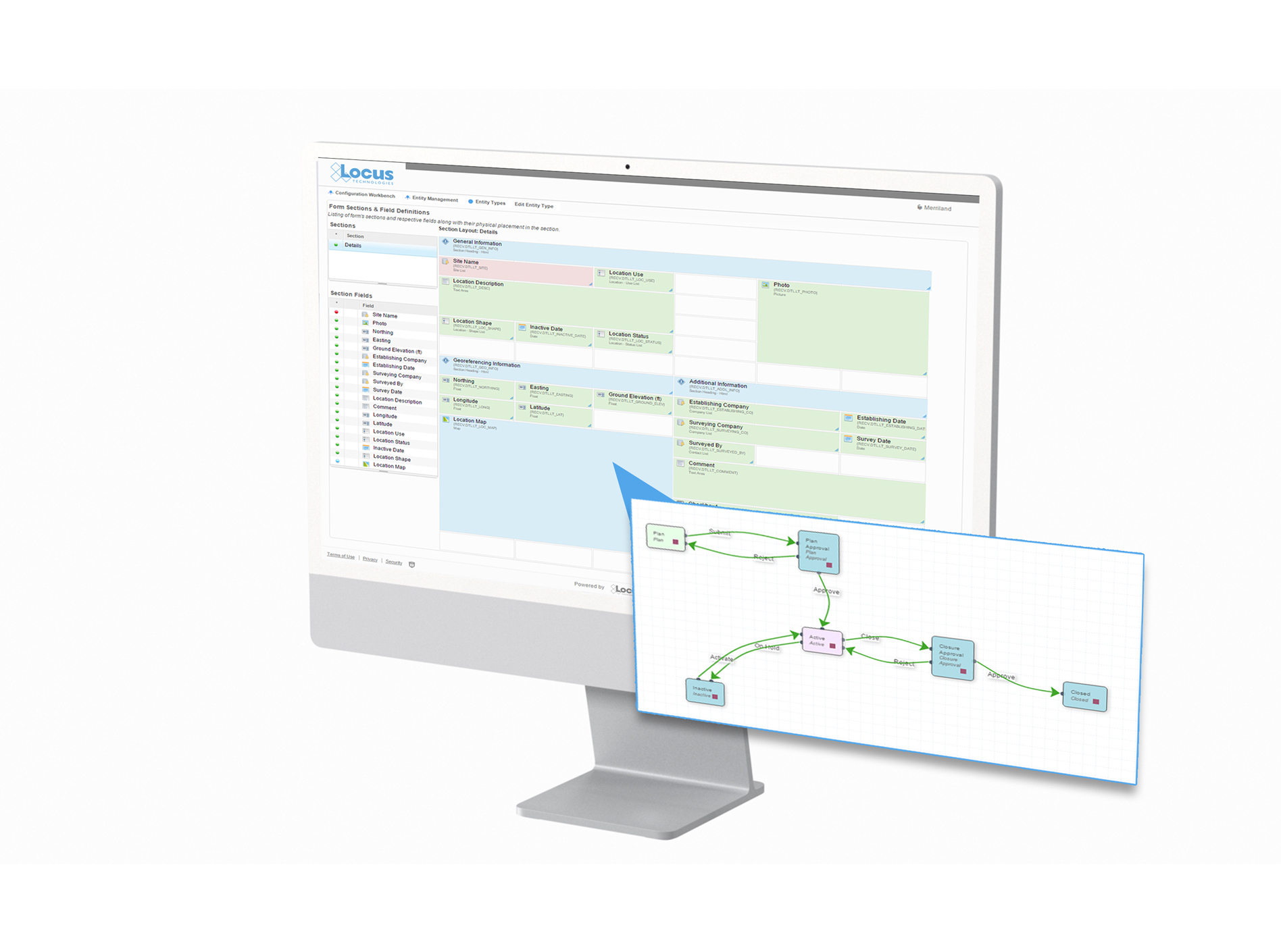 https://www.locustec.com/wp-content/uploads/2024/04/LP-2.jpg
1410
1896
Locus Product Team
https://www.locustec.com/wp-content/uploads/2023/12/locus_logo_2x.png
Locus Product Team2024-04-24 14:34:522025-09-17 08:09:15Better Permit Management for Construction Projects
https://www.locustec.com/wp-content/uploads/2024/04/LP-2.jpg
1410
1896
Locus Product Team
https://www.locustec.com/wp-content/uploads/2023/12/locus_logo_2x.png
Locus Product Team2024-04-24 14:34:522025-09-17 08:09:15Better Permit Management for Construction Projects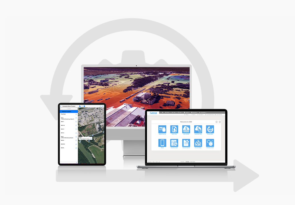 https://www.locustec.com/wp-content/uploads/2024/04/EIM-Simplify-1.jpg
722
1036
Dr. Todd Pierce
https://www.locustec.com/wp-content/uploads/2023/12/locus_logo_2x.png
Dr. Todd Pierce2024-04-17 14:18:302025-09-16 14:24:24EIM Simplifies Complexity
https://www.locustec.com/wp-content/uploads/2024/04/EIM-Simplify-1.jpg
722
1036
Dr. Todd Pierce
https://www.locustec.com/wp-content/uploads/2023/12/locus_logo_2x.png
Dr. Todd Pierce2024-04-17 14:18:302025-09-16 14:24:24EIM Simplifies Complexity https://www.locustec.com/wp-content/uploads/2024/04/27years_horizontal-e1712853106246.png
343
1000
Neno Duplan
https://www.locustec.com/wp-content/uploads/2023/12/locus_logo_2x.png
Neno Duplan2024-04-11 09:35:442025-10-16 09:51:53Celebrating 27 Years of Innovation: Locus’ Journey from Silicon Valley to Around the World
https://www.locustec.com/wp-content/uploads/2024/04/27years_horizontal-e1712853106246.png
343
1000
Neno Duplan
https://www.locustec.com/wp-content/uploads/2023/12/locus_logo_2x.png
Neno Duplan2024-04-11 09:35:442025-10-16 09:51:53Celebrating 27 Years of Innovation: Locus’ Journey from Silicon Valley to Around the World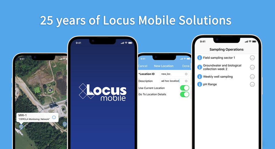 https://www.locustec.com/wp-content/uploads/2024/04/MobileAnniversary.jpg
520
960
Neno Duplan
https://www.locustec.com/wp-content/uploads/2023/12/locus_logo_2x.png
Neno Duplan2024-04-04 14:28:572025-07-28 14:12:03Pioneering EHS Compliance and Sustainability: Locus Mobile Apps Revolutionize the Industry
https://www.locustec.com/wp-content/uploads/2024/04/MobileAnniversary.jpg
520
960
Neno Duplan
https://www.locustec.com/wp-content/uploads/2023/12/locus_logo_2x.png
Neno Duplan2024-04-04 14:28:572025-07-28 14:12:03Pioneering EHS Compliance and Sustainability: Locus Mobile Apps Revolutionize the Industry